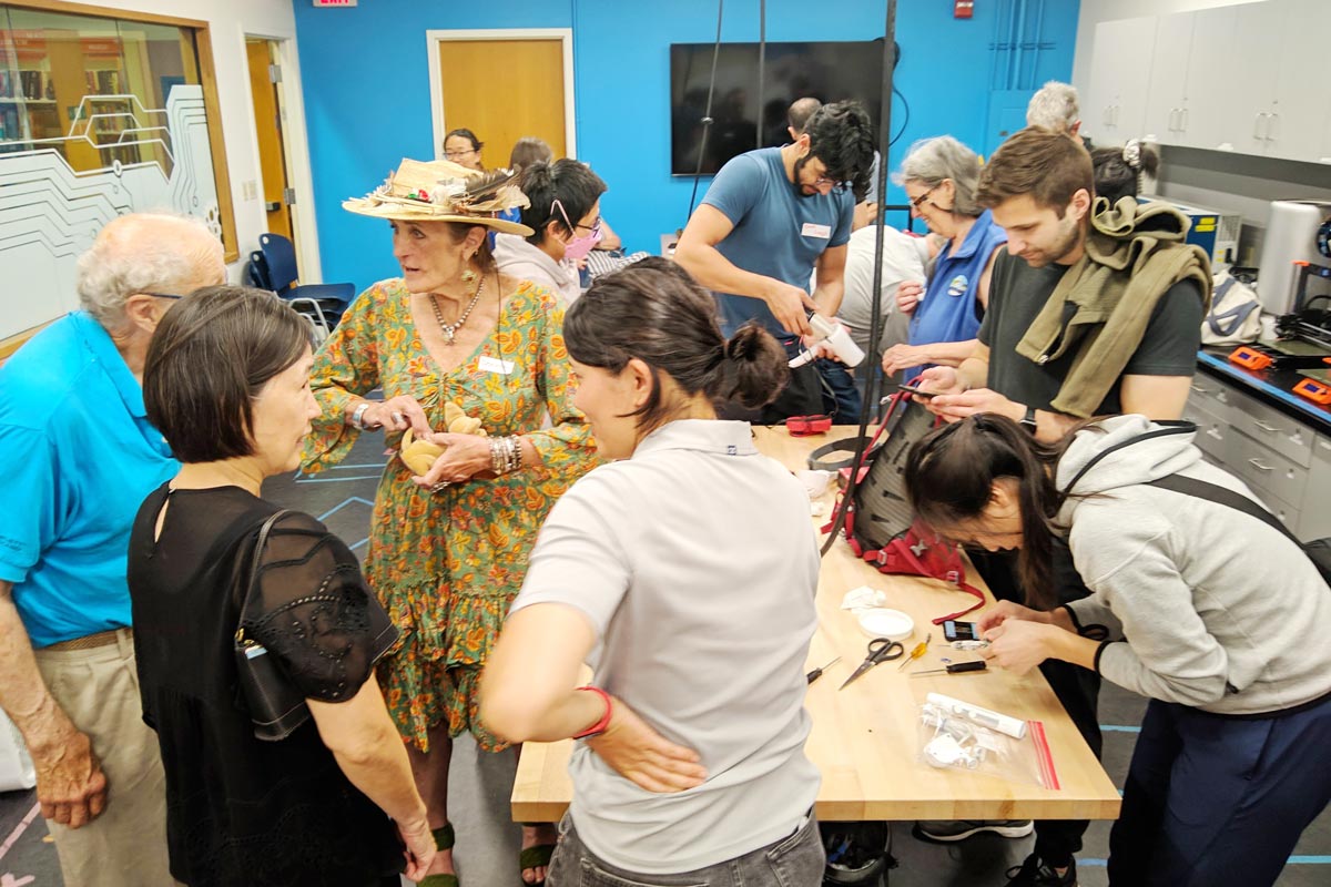
Using Translation

The County of San Mateo has added a translation feature developed by Google Translate to assist web visitors in understanding information on this website in a variety of foreign languages. Please be aware that Google Translate, a free third party service which the County does not control, provides automated computer translations that may not give you an exact translation. The County cannot guarantee the accuracy of translations through Google Translate so translations should not be considered exact and only used as a rough guide. Anyone relying on information obtained from Google Translate does so at his or her own risk. The County disclaims and will not accept any liability for damages or losses of any kind caused by the use of the Google Translate feature.

sea level rise risks on San Mateo County coastline
SEA LEVEL RISE
Building a resilient community.

Sea Level Rise

As the climate changes and sea levels rise, communities in the Bay Area are already experiencing the impacts of flooding. The magnitude and extent of sea level rise-linked flooding and erosion are expected to increase in the future. Learn more about storm-linked flooding.

Understanding how sea level rise is likely to affect San Mateo County residents, businesses, and the community services and infrastructure we all rely on is crucial to building prepared, healthy, and safe communities. 

Impacts

In addition to the flooding risk to many of our communities, our networked infrastructure is also at risk. Sea level rise is expected to affect us all through impacts to roads and highways, electric substations, and wastewater treatment plants that are essential to day-to-day community and economic functions. For example, a flooded highway, wastewater treatment plant or electrical substation could temporarily shut-down businesses, close roads and lead to many community-wide disruptions. By working together, we can protect our communities’ many assets, including neighborhoods, businesses, parks and beaches – places we all love.

Assessing Risks in San Mateo County

South Coast Sea Level Rise Risk and Solutions Study

STUDY AREA: from the southern edge of Half Moon Bay to the county line south of Pescadero

The SMC South Coast is known for its iconic beaches, agricultural areas, and small coastal communities. Many of these areas, including Coastside beaches and bluffs, roads, agricultural land, businesses and residences are already at risk from flooding and erosion, and these impacts will get worse as sea level continues to rise. Our communities need to know what to expect and what we need to start doing today to protect ourselves from these impacts.

This study evaluates the impacts of sea level rise on the South Coast right now, at .8 feet, at 1.4 feet and at 4.9 feet. The vulnerability assessment provides projections of the extent of coastal hazards and of the physical and economic impacts to community assets like buildings, roads, farmland, and coastal access infrastructure. Learn more in the Executive Summary (PDF) and the full report (PDF) or browse our interactive maps in English and Spanish to learn more about the study findings.

2018 San Mateo County Sea Level Rise Vulnerability Assessment

STUDY AREA: the San Mateo County coast and bay shorelines except for the south coast

Understanding how sea level rise will affect San Mateo County residents, businesses, and the services and infrastructure we all rely on is a crucial step in building prepared, healthy and safe communities. Sea level rise could affect a wide array of communities, critical facilities, energy networks, transportation systems, flood protection infrastructure, natural and recreational areas, wastewater and stormwater systems, and solid waste facilities. While the changing climate and rising seas pose many risks to people and places in San Mateo County, we can plan ahead to create resilient communities and ecosystems. 

Learn more in the 2018 San Mateo County Sea Level Rise Vulnerability Assessment (PDF) full report (appendices below) or browse the Highlights Brochure (PDF).

Appendices

Appendices A-C (PDF)

  • Appendix A: Methodology Report
  • Appendix B: Asset Exposure Maps
  • Appendix C: Asset Questionnaire Example

Appendix D: Asset Vulnerability Profiles (PDF)

Appendices E – P (PDF)

  • Appendix E: Data Sources
  • Appendix F: Asset Categorization and Classification Report
  • Appendix G: Inundation Scenarios for San Mateo County Sea Level Rise Vulnerability Assessment
  • Appendix H: Adapting to Rising Tides and Our Coast, Our Future – A Comparison of Approaches
  • Appendix I: Groundwater Resources Evaluation
  • Appendix J: Pacific Gas & Electric – Sea Level Rise in San Mateo County
  • Appendix K: Baylands Ecosystem Habitat Goals Science Update 2015
  • Appendix L: Stakeholder Group List
  • Appendix M: Summary of Local Sea Level Rise Planning Efforts
  • Appendix N: Recommendations for Next Steps from Stakeholders
  • Appendix O: Additional Resources
  • Appendix P: Glossary

Sea Level Rise Adaptation Strategies

There are many strategies available to address the challenges of sea level rise. San Mateo County Sea Level Rise Vulnerability Assessments have identified three key categories of adaptation strategies: (1) emergency preparedness and resilience efforts, (2) shoreline and site-specific strategies, and (3) policies, plans and procedure updates to address sea level rise. 

  • Adopt new development standards and ordinances for at risk areas.
  • Utilize nature-based solutions, including vegetated, permeable, and tree-covered surfaces, water detention systems and habitat restoration.
  • Update building design standards and codes to incorporate flood risk best practices.
  • Implement protection or accommodation approaches that attempt to stop erosion or flooding.
  • Consider managed retreat or hazard avoidance, which relocates or realigns potentially vulnerable infrastructure.

The San Mateo County Flood and Sea Level Rise Resiliency District (“OneShoreline”) began operating in 2020 to coordinate countywide efforts to combat the harms of sea level rise caused by climate change. OneShoreline provides expertise in the complex process of designing and building for sea level rise, working with cities and developers to build resilience through planning and coordinating multi-jurisdictional flood mitigation projects. Learn more about OneShoreline.

Planning for Sea Level Rise

Sea Level Rise Policy for County-Owned Assets

In 2019, the Board of Supervisors approved a Sea Level Rise Policy for County-Owned Assets. The Policy requires that sea level rise is considered in all County-owned and operated assets, design and construction projects, leases, and property acquisitions and dispositions. The intent of this policy is to understand the vulnerability of County-owned property and assets over their life cycle; develop an incremental approach to adaptation based on the current and future level of risk; and coordinate with other communities on developing regional solutions.

Learn more through the 2019 San Mateo County Sea Level Rise Policy for County-Owned Assets (PDF) and Implementation Plan (PDF).

Past Sea Change Initiatives

2019 SeaChange SMC Community Resilience Grants

The SeaChange SMC Community Resilience Grants Program supported cities and organizations in developing solutions that reduce impacts from sea level rise. Learn more.

Assessing Nature-Based Shoreline Protection Strategies for SMC

Nature-based strategies protect shorelines from coastal flooding by creating, restoring, or emulating natural coastal features, such as wetlands, dunes, or reefs. These strategies reduce erosion and mitigate storm surge, wave action, and still-water flooding associated with coastal flood events.

SeaChange SMC worked with Stanford’s Natural Capital Project (NatCap) and the San Francisco Estuary Institute (SFEI) to explore and evaluate a menu of nature-based sea level rise strategies for the County’s Bay shoreline. The project identified “Operational Landscape Units” OLUs with shared geophysical and habitat characteristics suited for particular sets of adaptation strategies. These natural “neighborhoods” cross jurisdictional and traditional decision-making boundaries making coordination essential to achieve successful adaptation.

Five factsheets (see below) summarize the San Mateo County bayside risks from sea level rise, nature-based opportunities to reduce these risks, and the potential ecosystem services that could be achieved through OLU-focused nature-based strategies. 

This project was funded by The Gordon and Betty Moore Foundation.

Factsheets

The Latest News & Events

Fixit Clinic @ John Daly Library
Jun
7

Fixit Clinics are fun community-based workshops where neighbors, friends, and families work collectively to learn how to repair broken items.

Keep All Plastic Out of the Green Bin Everyone in San Mateo County is required to compost all food scraps and yard…
Getting food to people who need it while also reducing food waste requires many hands. As one food recovery non-profit…