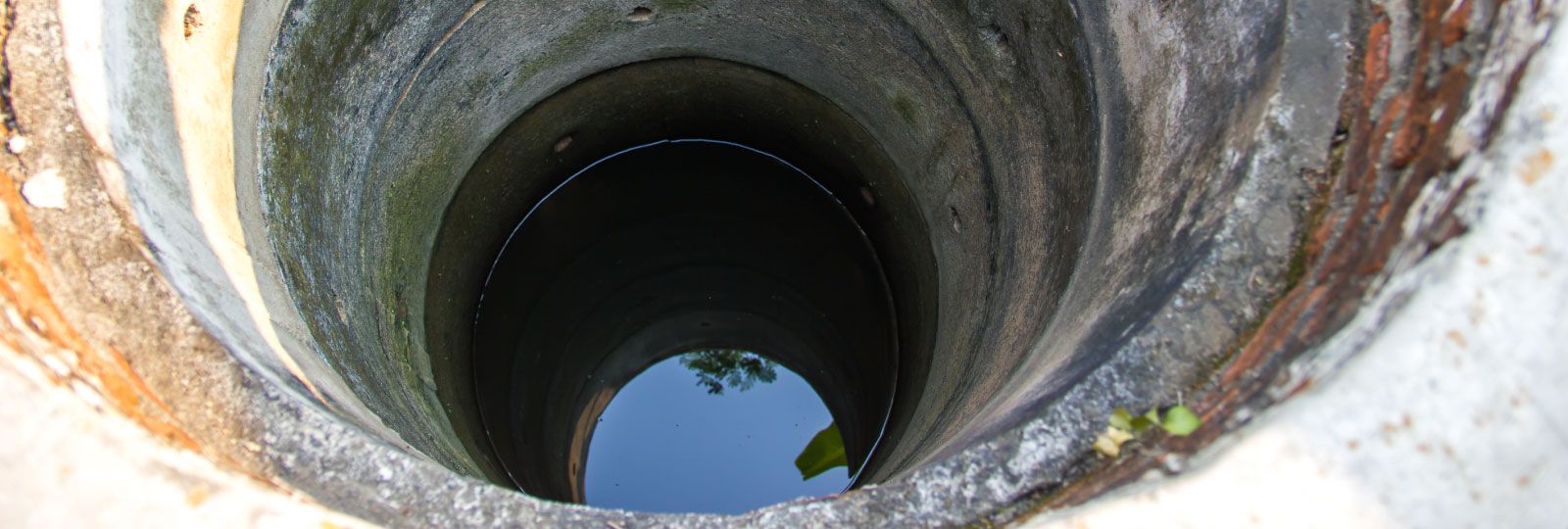
Groundwater
Groundwater 101
Did you know that groundwater accounts for less than 2 percent of the total water on Earth? Even so, groundwater is a crucial resource: in California, it provides about 40 percent of our total water. In years of drought, that number jumps up to 60 percent. Some communities rely on groundwater as their only source of water. Groundwater can provide a necessary backup to local water supply, but only if we protect it.
Groundwater fills spaces in soil and cracks in rocks, and the amount of groundwater is constantly changing:
- It is replenished, or recharged, by rain, snowmelt, stream water, leaky underground pipes, and irrigation water.
- It is depleted through natural processes like flow to rivers, lakes, and oceans, evaporation and transpiration, and by human use.
Groundwater does not follow the boundaries of cities, counties, or states. Instead, we think about groundwater in terms of basins and subbasins. A groundwater basin is an area made up of at least one aquifer (area that contains groundwater). And a groundwater subbasin is a portion of a groundwater basin, oftentimes created for ease of management and studying.
Impacts to Groundwater
The recent drought in California has caused a greater reliance on groundwater for drinking water and irrigation. However, major problems arise when we use groundwater faster than it is recharged, called groundwater overdraft. In 2016, there were 21 basins in the state that were experiencing overdraft.
Groundwater overdraft causes many problems, including:
- The need to drill existing wells deeper or drill new wells to access deeper aquifers
- Land subsidence, or sinking of the land surface due to the compaction of clays
- Salt water intrusion into coastal groundwater basins
- Groundwater pollution
Keeping Our Water Clean
Groundwater Protection
The goal of the Groundwater Protection Program is to protect underground water supplies and waterways from chemical pollution. Inspection staff oversee clean-up of pollution caused by leaking underground tanks and chemical spills. They work with other agencies, such as the Environmental Protection Agency (EPA) and the Water Quality Control Boards, to make sure the clean-up process follows State and local laws. Groundwater Protection Program staff also issue permits for installing wells and soil borings for geotechnical or environmental investigations.
Website: Learn more about the Groundwater Protection Program here.
Groundwater in San Mateo County
The County of San Mateo is dedicated to protecting the quality and quantity of groundwater resources within its borders.
There are nine groundwater basins with boundaries –either partial or whole—within San Mateo County. Click on each basin to learn more.
Additional Resources
- Bibliography of Potential Sources of Data for San Mateo County
- County of San Mateo Health System, Groundwater Protection Program
- Department of Water Resources, Groundwater Management
- Department of Water Resources, Groundwater Basins Map
- San Francisco Regional Water Quality Control Board Groundwater Committee
- USGS San Francisco Bay Groundwater Quality Report
- USGS San Francisco Bay Groundwater Quality Fact Sheet
- Groundwater Depth Data Compiled by UC Berkeley
Frequently Asked Questions
-
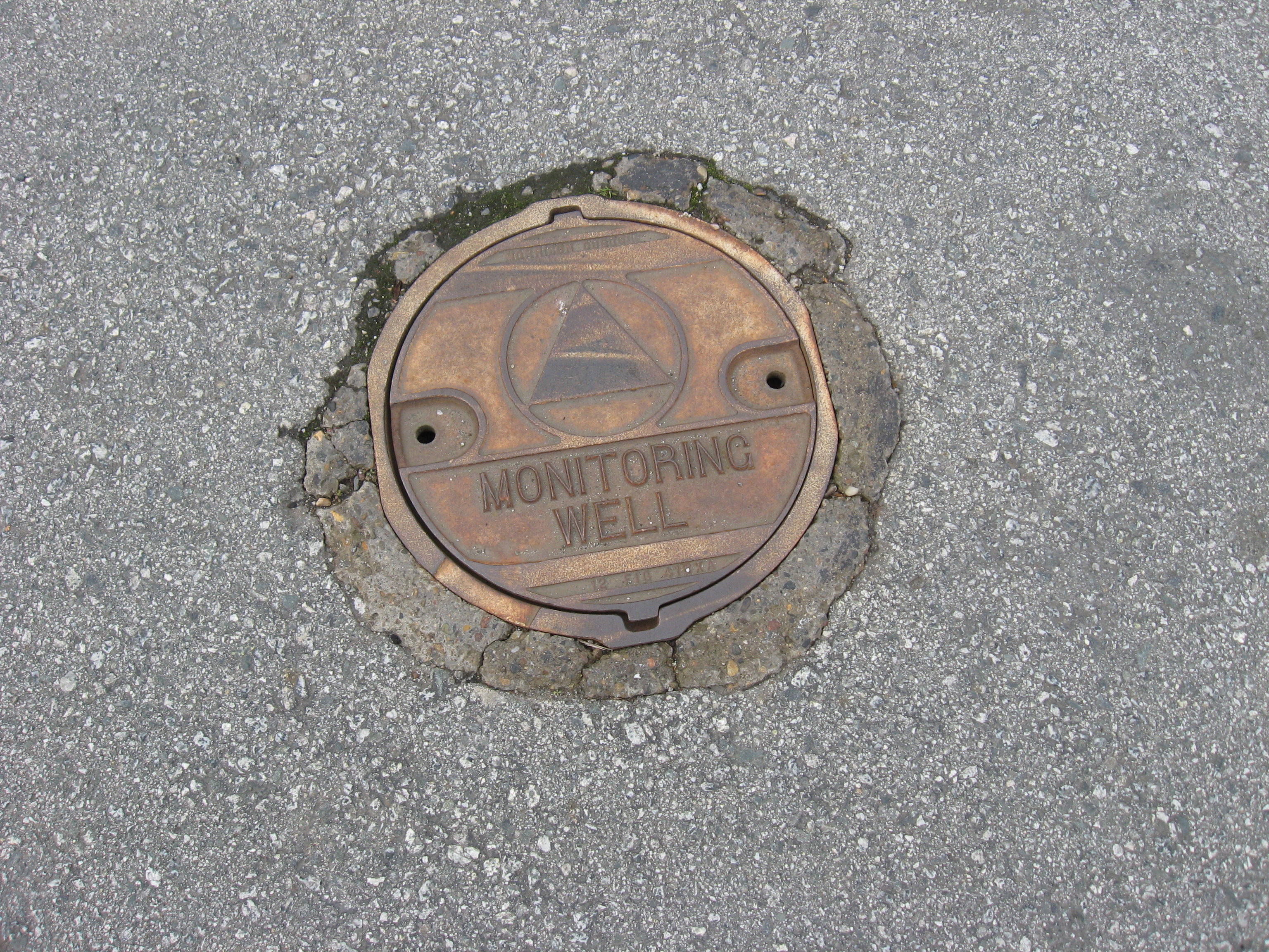
How many wells are in my area and where are they located?
View the California Department of Water Resources (DWR) well logs inventory. A well log is required to be submitted to the state for every well drilled. You can filter the city field by the location of interest or planned use/future use field by the use of interest. Please note, these are the number of wells ever installed; each of these wells’ current status (e.g. active, temporarily inactive, destroyed) is not tracked by DWR. To view the actual driller’s well log, click on the link in the final column. You can view the well types map to view where the wells are located. This data was collected as part of the recent San Mateo Plain subbasin assessment, which included data collection on well information for areas outside of the San Mateo Plain subbasin.
-
What is groundwater used for in my area?
The well types map is color coded in the legend to show all public water supply, private water supply, cathodic protection, irrigation, environmental monitoring, test, and other wells. If you are interested in wells that usually are associated with groundwater extraction then you would focus on the public water supply, private water supply, and irrigation wells.
San Mateo County does not have a water management agency like our neighboring counties so what the groundwater is used for (and more specifically how much is used) is not exactly known. As implied by the well types, some wells could be used for drinking water supply (most likely for public and private emergency backup supply but could be for private domestic use) while most are likely for irrigation purposes. There may be other purposes such as commercial/industrial processes.
Note: This data was collected as part of the recent San Mateo Plain subbasin assessment, which included data collection on well information for areas outside of the San Mateo Plain subbasin. The final assessment report (page 207) does have annual average estimates for extractions within the San Mateo Plain subbasin.
-
How deep is groundwater?
The groundwater levels map shows locations of wells only where we were able to also find at least one depth to water measurement in the source of the data. Select a well to view the specific groundwater depth information associated with it. This map is also color coded to show which depths the wells are specifically targeted (i.e. where the wells screen is located below the ground surface).
-
What is the County doing related to the Sustainable Groundwater Management Act (SGMA)?
Currently all 9 basins within San Mateo County are designated as Very Low Priority and are not required to comply with SGMA. If you would like to discuss the County’s efforts related to SGMA further, please contact Charles Ice at 650-399-6911.
-
What is the County’s involvement in the Westside Basin?
The County is not facilitating any activities within the Westside Basin. There is a voluntary Groundwater Management Plan for the southern part in San Mateo County. You can contact SFPUC, Daly City, San Bruno, or CalWater directly for more information on efforts in that basin.
San Mateo Plain Subbasin
The San Mateo Plain Subbasin underlies the bayside of San Mateo County from approximately the City of San Mateo on the north, to approximately the County boundary at San Francisquito Creek on the south. Currently, there is no entity actively managing the basin.
The Sustainability Department and the Environmental Health Services division of San Mateo County Health jointly completed a groundwater basin assessment of the San Mateo Plain Subbasin to assess the groundwater resources and current condition of the subbasin; and identify potential groundwater management strategies. The project was funded by Measure K (formerly Measure A), a countywide half-cent general sales tax passed by voters, and the Sustainability Department.
Work on the assessment commenced in April 2016; the assessment was completed in August 2018. The development of the groundwater basin assessment was a collaborative process. The Sustainability Department and Environmental Health Services held a series of workshops to solicit public and stakeholder feedback.
Project Reports and Presentations
- March 19 Meeting: California Statewide Groundwater Elevation Monitoring
- Final Report (211 MB), July 2018
- Public Review Draft (207 MB), June 2018 and Response to Comments, July 2018
- CASGEM Presentation (1.3 MB), January 2018
- Final Phase I Report (104 MB), January 2017
Project Data
- All GIS data can be viewed on San Mateo County GIS Open Data
- Numerical groundwater model files (784 MB compressed), including historical basin conditions and the four modeled scenarios. Visit United States Geologic Survey’s website to download MODFLOW for free to use with these files
- Project Database (42 MB compressed), of well data
- Maps:
- Well types: locations of wells, color coded by type
- Well construction: location of wells, color coded by era of construction date
- Water levels: location of wells, with water level measurements color coded by depth
- Water quality: location of wells, with water quality measurements of 10 parameters shaded by concentration
- Searchable map: location of wells with user selected water quality parameters with user defined types and depths
- Bay Mud/tidal study measurements (1.75 MB compressed), in Excel. Specific subset of Project Database
- Well logs from California Department of Water Resources, as of April 2016
Stakeholder Outreach Resources
| Date | Location | Materials |
|---|---|---|
| July 12, 2018 | Redwood Shore Public Library, Community Room 399 Marine Parkway, Redwood City | Agenda Presentation Discussion Feedback |
| April 17, 2018 | Sobrato Community Conference Center Redwood Shores Shoreway Conference Room 350 Twin Dolphin Drive, Redwood City | Agenda Presentation |
| February 2018 | N/A | Email Update |
| November 9, 2017 | Jennings Pavilion, Holbrook-Palmer Park 150 Watkins Avenue, Atherton | Agenda Presentation |
| August 17, 2017 | Sobrato Community Conference Center Redwood Shores Shoreway Conference Room 350 Twin Dolphin Drive, Redwood City | Agenda Presentation Discussion Feedback |
| May 2017 | N/A | Email Update |
| January 31, 2017 | Redwood Shore Public Library, Community Room 399 Marine Parkway, Redwood City | Agenda Presentation |
| December 6, 2016 | Emergency Operations Center Belmont City Hall, 2nd Floor #1 Twin Pines Lane, Belmont | Agenda Presentation Discussion Feedback |
| November 21, 2016 | Menlo Park's Arrillaga Family Recreation Center 700 Alma Street, Menlo Park | Agenda Presentation |
| September 7, 2016 | Wind Room, Foster City Community Center 1000 E. Hillsdale Ave, Foster City | Agenda Presentation |
| May 17, 2016 | Oak Room, San Mateo County Library 55 W. 3rd Ave, San Mateo | Agenda Presentation Discussion Feedback |
Additional Resources
- Atherton Newsletter, Winter 2016
- Stanford Water in the West Blog Post, April 2017
- San Mateo Plain Groundwater Reliability Partnership
- San Francisquito Creek Joint Powers Authority
- 2019 Shallow Groundwater Workshop Summary
- 2019 Technical Memo: The Shallow Groundwater Layer and Sea Level Rise, Description of Approaches
Groundwater Reports
- California Department of Water Resources Bulletin 118: San Mateo Plain Subbasin
- Geologic, Hydrologic, and Historical Use of the SMP
- Geotechnical Analysis of Soil Sediments in Abandoned Irrigation Wells
- Groundwater Supply and Water Storage Investigation
- Survey Report on San Francisquito Creek
- Comments on a Comprehensive Groundwater Protection Evaluation
For more information on the San Mateo Plain Subbasin assessment, please contact Charles Ice at cice@smcgov.org
Groundwater Information from Cities
- City of Palo Alto Recycled Water Program
- City of Palo Alto Groundwater Assessment
- City of East Palo Alto Groundwater Management Plan
- City of East Palo Alto Groundwater Management Plan- Appendices
- Feasibility Of Supplemental Groundwater Resources- Menlo Park and East Palo Alto
- East Palo Alto Water Security Feasability Study
- Shallow Aquifer Use and Recharge in Redwood City
- Groundwater Development in Atherton
For more information on the San Mateo Plain Subbasin assessment, please contact Charles Ice at cice@smcgov.org
Visitacion Valley Basin
The Visitacion Valley Groundwater Basin is a roughly triangular shaped basin in the San Francisco Bay Hydrologic Region within the City of San Francisco. For additional basin details please check out California Department of Water Resources Bulletin 118: Visitacion Valley Basin.
Half Moon Bay Terrace Basin
The Half Moon Bay Terrace Groundwater Basin is located along the northern San Mateo coast about 20 miles south of San Francisco and 90 miles southwest of the Sacramento Valley. For additional basin details please check out California Department of Water Resources Bulletin 118: Half Moon Bay Terrace Basin.
Additional Resources
- El Granada Groundwater Investigation Report
- Draft Montara-Moss Beach Water Well EIR
- Final Montara-Moss Beach Water Well EIR
- Plants and Animals in Montara Moss Beach Study
- Midcoast Groundwater Study Phase II
- Midcoast Groundwater Study Phase II – Volume II
- San Mateo County Midcoast Groundwater Study Phase III
- San Mateo County Mid-Coast Aquifers
- Technical Memorandum No. 1 Midcoast Groundwater Study Phase II
- The Resurrection of the Half Moon Bay Oil Field
- Pillar Point Marsh Hydrology
- Half Moon Bay Pillar Point Marsh Groundwater Basin Phase I
- Half Moon Bay Pillar Point Marsh Groundwater Basin Phase II
- Half Moon Bay Pillar Point Marsh Groundwater Basin Phase II Supplement
- Denniston Creek Groundwater Investigation
- Denniston San Vicente Water Supply Draft EIR
- Denniston San Vicente Water Supply EIR Volume I
- Denniston San Vicente Water Supply EIR Volume II
- Marchant Resort Impact
- Test Wells Ocean View Farms
Islais Valley Basin
The Islais Valley Groundwater Basin, within the city of San Francisco, is in the San Francisco Bay Hydrologic Region. For additional basin details please check out California Department of Water Resources Bulletin 118: Islais Valley Basin.
Westside Basin
The Westside Basin underlies both northern San Mateo County as well as the City and County of San Francisco. The basin is jointly managed by City of Daly City, City of San Bruno, City of Burlingame, Town of Colma, City of South Francisco, City of Millbrae, California Water Services Company, and San Francisco Public Utilities Commission.
The managing entities are currently working on a joint Regional Groundwater Storage & Recover (GSR) project that includes the construction of up to 16 new recovery wells in northern San Mateo County and facilities consisting of chemical treatment equipment, tanks, pumping systems, and associated pipelines. As part of the GSR project, surface water will be used instead of groundwater in wet years, allowing the groundwater to recharge through rainfall and decreased pumping. This will create a savings account of up to 20 billion gallons of groundwater that will be stored in the basin.
For additional basin details please check out California Department of Water Resources Bulletin 118: Westside Basin.
Additional Resources
- Regional Groundwater Storage and Recovery Project
- North Westside Basin Groundwater Management Plan
- South Westside Basin Groundwater Management Plan
- Hydrogeologic Conditions in the Westside Basin
- Dimensions of the Westside Groundwater Basin
- Evaluation of the Impact of Chemical Constituents Upon Daly City Water Wells
- Groundwater Investigation and Wellhead Protection Program for Greater San Bruno
- Results of the 2000 Water Quality Analysis at Selected Wells in Westside Groundwater Basin
- Bay Mud Evaluation
Pescadero Valley Basin
The Pescadero Valley Groundwater Basin is located in southern San Mateo County along the Pacific Ocean about 30 miles south of San Francisco. For additional basin details please visit California Department of Water Resources Bulletin 118: Pescadero Valley Basin.
Additional Resources
- Evaluation of Test Well Warheit No. 1
- Hydrologic Changes Associated with Loma Prieta Earthquake
- Initial Study and Negative Declaration for the Warheit Well Water Supply Alternative
- Summary – Geology and Groundwater Hydrology in the Proximity of the Warheit Well and Bean Hollow Nursery
- The Potential for Developing Groundwater Supplies in Pescadero
- Warheit Water Test Well Near Pescadero
- Water Quantity and Quality Impact Study Bean Hollow Housing Project
San Gregorio Valley Basin
The San Gregorio Valley Groundwater Basin is located in southern San Mateo County along the Pacific Ocean about 25 miles south of San Francisco. For additional basin details please visit California Department of Water Resources Bulletin 118: San Gregorio Valley Basin.
Additional Resources
San Pedro Valley Basin
The San Pedro Groundwater Basin is located in northern San Mateo County along the Pacific Ocean. The basin is about 10 miles south of San Francisco, and 80 miles southeast of the Sacramento Valley. For additional basin details please visit California Department of Water Resources Bulletin 118: San Pedro Valley Basin.
Año Nuevo Area Basin
The Año Nuevo Area Groundwater Basin is located in southern San Mateo County along the Pacific Ocean fifty-five miles south of San Francisco. For additional basin details please visit California Department of Water Resources Bulletin 118: Año Nuevo Area Basin.